Mbanza-Ngungu
Mbanza-Ngungu | |
|---|---|
Territory | |
| Coordinates: 5°15′S 14°52′E / 5.250°S 14.867°E | |
| Country | |
| Province | Kongo Central |
| Seat | Mbanza-Ngungu |
| Area | |
• Total | 8,190 km2 (3,160 sq mi) |
| Population (2004) | |
• Total | 100,000 |
| • Density | 12/km2 (32/sq mi) |
| Time zone | UTC+1 (WAT) |
Mbanza-Ngungu, formerly known as Thysville or Thysstad, named after Albert Thys, is a city and territory in Kongo Central Province in the western part of the Democratic Republic of Congo, lying on a short branch off the Matadi-Kinshasa Railway. It has a population of nearly 100,000 people.
Overview
[edit]Formerly known as a resort town, it is home to the Thysville Caves, which encompass the entire range of the colourless African blind barb. It is home to a major FARDC garrison: the 1st Armoured Brigade was based here during the early 1990s period.[1] The 1st Armoured Brigade was first listed in the IISS Military Balance in 1982-83 edition, implying that the brigade may have been created during that period.[2] The city's other main industry is railway engineering.
The city is currently the main site of Kongo University.
Notable people
[edit]- Daniel Mukoko Samba (born 1959), politician
Gallery
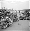
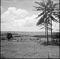
[edit]Swiss photographer Annemarie Schwarzenbach, took photos from May 1941 until March 1942. They are shown below.
-
Two (2) trains, one has derailed, the other came to help.
-
Daily life.
-
View of the village.
-
Hills around Mbanza-Ngungu.
See also
[edit]References
[edit]- ^ Ed. by Sandra W. Meditz and Tim Merrill, Country Study for Zaire, 1993, Library of Congress
- ^ IISS Military Balance 82/83, page 71


